The Spanish Peaks first
caught my attention in 2003. Searching for a hiking destination, I stumbled
upon a picture of the eastern most 13’er & 12’er in the U.S. and instantly
became obsessed with the two impressive peaks. Not yet an ultra-runner, the idea that someone
could run up a mountain would not have occurred to me and at the time I had
never even hiked above 11,000 feet. That
first trip to the Cuchara valley was life changing. I would return to explore
the area over the next few summers hiking both
West & East Spanish Peaks, Teddy’s Peak, Trinchera Peak, Quatro Peak, Leaning
Peak, & Boyd’s mountain, and had made nearby trips north to the Wet
Mountains and west to the Sangre de Christo’s around Blanca Peak. A deep love
of the mountains was born in the Cuchara Valley. Becoming a trail and ultrarunner
in the years since first setting eyes on “the Wahatoya”,
I discovered that running in the mountains is not only possible, but that I was
pretty good at it. Lately I had been feeling a strong pull back to the
Spanish Peaks. When MURCA announced a 3rd annual Virtual 50K, it was
just the excuse I needed for a return to the Cuchara Valley after 12 years away.
MURCA, or the Marine Ultra Runners Club of America, is a group
of Ultra-Running Marine Veterans. Made up of current and former Marines, it’s a
group of legitimate bad-asses. It doesn’t take a long look at the MURCA
Facebook page to understand these men & women are awesome. There are huge,
epic, & humbling accomplishments posted every day! I am honored to be a member
and have met great people both online and in-person since joining their
ranks. As I said in last year's V50K run report; more than just a Facebook group, MURCAns
across the country (and around the world) reach out, encourage, and support
each other; it’s tangible. It’s a positive and motivating environment that also
provides me with the connection to Marines that I'd been missing since leaving
active duty ten years ago.
One Marine who especially embodied this MURCA spirit
was Bob “Iceman” Coolidge. In many ways, the Iceman is MURCA. Never having
met in person, we developed a great relationship over face book. I became
accustomed to seeing his input and positivity on my feed about not only
ultra-running, but life in general. He was interested in my family, my work,
and me not just as a runner but as a former Marine. We exchanged messages about
running and anything else. Just brimming with positive vibes and encouragement, his phrases like “Getchu-some”
and “nothing but a thang” started to weave their way into my vocabulary. And it wasn’t just me, many MURCAns have described a
similar relationship with the Iceman and many more were fortunate enough to
meet him in person. I too, looked forward to meeting him in the flesh at a future
race. Bob passed away while travelling in February. A Marine’s Marine and instant
friend to all Murcans; it is beyond fitting that the Murca V50K Most Epic Award
is now named for him (an award he won in 2019 when he rocked out a 50K shortly after surviving a heart attack!).
The
2020 MURCA V50K is also once again a fundraiser for the Warriors
Keep, a non-profit organization whose
“…mission is to unite, empower, and enhance the quality of life for veterans
with the use of outdoor adventure and recreational therapies”. The 2020 MURCA V50k window was here; it was
time to run for Warriors Keep, time to run for the Iceman, and time to go on an
epic adventure worthy of MURCA!
With a 3am wake-up on Sunday
morning, I set out for the Cuchara valley from my home in Topeka Kansas. I’d
recently made some minor “overland” modifications to the X-Terra making it more
suitable for trips to the wilderness and car camping and was excited to see it
in action. It was good to get out on the open road. As the Director of a Health
Center, I’d been going a thousand miles an hour since February due to the
COVID-19 pandemic. With a deep exhale as I drove out of Topeka, it was like a
weight was lifting. For weeks it had looked like this adventure wouldn’t be
able to happen among travel bans and quarantines. Kansas had moved into “phase three” of the re-opening plan and Colorado had no Kansas travel restrictions in
place. The case rates in the counties I would be visiting were very low (or
zero) and going dirt-bag style would mean very limited human interaction. I had
also left the health center in the more-than-capable hands of a leadership team
who had been right there doing great things on the front lines of the pandemic.
As a Healthcare professional, I felt confident my adventure was safe and
responsible but more than anything, I felt grateful that it was happening. After
a 10-hour drive I was in the Cuchara Valley scouting out the trail head and
doing a short run around 11,000 feet. Feeling good to be back in the mountains,
I drove down to around 8,000 feet, found a good camping spot on the shores of Monument
Lake, ate one of my Wife’s awesome sandwiches, got my gear ready for the next
day, and tried to get some sleep.
The original plan was to set
out from the Cordova Pass Trailhead (11,243 ft) and summit West Spanish Peak
(WSP) via the Southwest ridge route, drop back down the ridge route and hit the
Apishapa Trail connecting it to the long and unforgiving Wahatoya Trail that,
according to the map, descends around the south side of WSP only to climb up
again to the saddle between WSP and East Spanish Peak (ESP). From there it
would be a scramble up the west ridge of ESP and retracing the path back on the
Wahatoya, the Apishapa, and finally, the WSP trail to the trail head. According
to my official map, this would put me right at 32 miles and around 10,000 –
12,000 feet of vert. But things don’t always go as planned in the mountains. It already started going awry on Sunday night
as I climbed into the sleeping bag nursing a massive headache. This was new for
me. My modus operandi for running at altitude is to arrive and immediately do
some running & hiking around 10,000 to 11,000 feet, forcing my body to
work. I then drop down to around 8,000 feet or below to sleep. The next day,
I’m always good-to-go for ultras up high. Climb high, sleep low. Doing this on
more trips than I can remember, altitude had just never caused any issues
beyond slowing my pace a little. However, past performance at altitude never
predicts future success or so I’d heard…I was about to see for myself.
I awoke headache-free at 0330
on Monday morning and made the drive back up to the Cordova Pass trail-head for
a “first-light” start. Normally, I prefer Alpine starts but with WSP’s
intimidating west ridge only a couple miles from the trail head, it would be
better to not climb in the dark. With no actual trail up the steep ridge, it is
class 2 unless you wander off course in which case there is plenty of class 3
& 4 to be found. I stepped off at 0520 and made short work of the approach
trail and the switchbacks up to tree-line. At 13,628 feet, WSP looms over the
whole region and while the standard route starts at 11,243 feet, it gains the
final 1,600 feet to the summit in less than 1 mile. Hitting the ridge, my pace
really fell off. Even in the morning light, I somehow got off route and ended
up doing a lot of class 3 scrambling. I knew it was a bad start to the day as
the minutes were ticking…
 |
| Looking back down the class 2 portion. |
Finally, I hit the summit
ridge and ran up to the top, took some pictures and enjoyed one of the finest
views in all of Colorado as I looked back home to Kansas, south to New Mexico
and Wheeler Peak, west to the snow covered Culebra range, northwest to Blanca,
Lindsey, and the Sangre de Christos, and North to the Wet Mountains and Pike’s
Peak just barely visible beyond. On the way up, I had gotten frustrated about
losing so much time, but standing there on the Summit it didn’t matter. There
would be a chance to make up time with a quick descent; besides, the summit was
a reminder of why I was there…of what I was doing. It was supposed to be hard. As
I usually do in the mountains, I thought of Anatoli Boukreev’s words
“…mountains
are a completely different world…You cannot conquer them, only rise to their
height for a short time; and for that they demand a great deal. The struggle is
not with the enemy, or a competitor like in sports, but with yourself, with the
feelings of weakness and inadequacy. That struggle appeals to me”
I was certainly feeling slow
and inadequate but like Iceman would say, “ain’t nothin but a thang”. It
was time to get moving again. Dropping down the west ridge was fast. Maybe too
fast as the quads were really working. Having just decided in a moment of Zen
on the summit that time didn’t matter, I looked at my COROS anyways as I hit the WSP/Apishapa trail
junction; it read 13:49 pacing. Cool. If I could keep the pace reading between
10:00 & 16:00 on the roller coaster Wahatoya trail, it would more than make
up for the time I lost scrambling up the class 3 crap. From the WSP/Apishapa trail
junction, it was an uneventful 2-mile low grade descent to the junction with
the Wahatoya trail. Actually, “uneventful” is not a word to use in the
mountains. The views to the south and west were phenomenal and demanded a few
picture stops!
 |
| Looking NW from the Summit. Blanca Massif in the distance. |
At the 7.3-mile mark I hit
the Apishapa/Wahatoya trail junction hoping to refill my water bottles. I was
counting on the many stream crossings for water refills. As it turned out, the
entire area was in a drought and had a burn ban in effect. The streams were
bone dry. I hoped that water wouldn’t be an issue but at that point I was still
feeling fine and also had on my hydration vest w/2L of water. I turned onto the
Wahatoya trail and kept moving.
Not a part of either peak’s
standard route, the Wahatoya trail does not get much traffic beyond out and
back day-hikers from the Apishapa trail head looking for quick views of the
many large dikes that jut out from all sides of the peaks. The trail climbs and descends many times as it
navigates around, over, and through some of these dikes. The terrain was
extremely variable. It alternated runnable single track with some of the most
gnarly talus and scree I’ve ever had to run over. Running the flats &
descents and power hiking the steeper talus covered climbs, the miles were now
ticking off. I was feeling decent but also felt the temperature increasing. It
had been windy & cold on the summit of WSP but down on the south flank of
the mountain it was starting to get pretty warm. About 10 miles in, the Wahatoya
trail started to fade & got tough to follow. The lack of use was really
becoming apparent. At the point my watch read 12 miles the trail was completely
gone and I was travelling overland, bush-whacking through wretchedly difficult
terrain. All my senses were on alert and I started to worry about getting lost.
The WSP wilderness is vast and unforgiving. Legend says Spanish militia never
made it out of the wilderness. Supposedly, their treasure from the lost Spanish Mine is still out there somewhere.
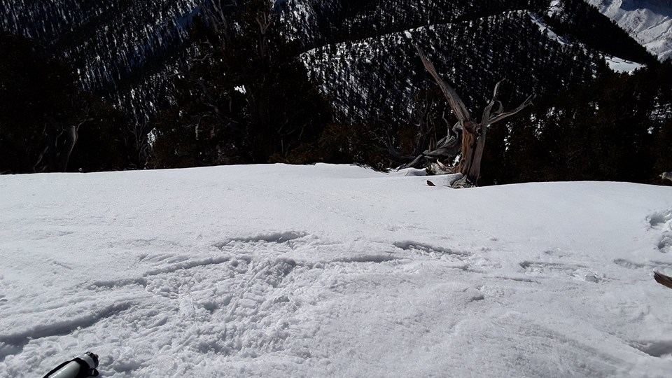
 |
| Trail got really gnarly in places |
Attempting to follow what
seemed to be the most logical path, I lost a ton of time going cross country.
When I climbed to the top of one of the dikes to get a look at the surrounding terrain
my heart sank. It was obvious I was way off track. Achieving the saddle would
be possible but would likely take many hours bushwhacking over brutal country
and would put me on the ESP summit way too late in the day for a Colorado
summer that’s notorious for storms. Being already far behind schedule and far
off course, I decided to reverse and make my way back to the point the Wahatoya
trail disappeared into the wild.
Feeling a little dejected, I
followed my mental map backwards and emerged onto the trail about 45-minutes
later. Now I knew why no one had ever connected the two peaks by this route. A
double summit was off the table. As I ran back west along the Wahatoya trail,
some mental math revealed that a run back to the trail-head without the planned
ESP summit would leave me 9 miles short of a 50k. The previous night’s headache
had also come back. My pace slowed dramatically and with a couple of hours already
lost to bushwhacking it was shaping into a long day. The inner monologue was
telling me a 22-mile day would be fine and the solo 50k at Lake Perry I had run
in April would be a good MURCA 50k to turn in. The inner monologue can act like
a little bitch sometimes. A bad day in the mountains is still a day in the
mountains. I had the Spanish Peaks Wilderness all around and decided I would
find a way to get the full distance, no matter how long it took or what route I
had to run.
Hitting the Apishapa/Wahatoya
Junction again, I realized that I could run down 1.5 miles south to the Apishapa
trail-head. This “little” out-and-back would leave 6 miles to make up instead of
9. Descending the 1,000 feet could also be good for the headache. I took off
down Apishapa with a renewed sense of energy, bombing the many switchbacks and
enjoying the changing variety of trees and geology with the descent.
 |
| Apishapa/Wahatoya Junction |
Whenever I’m running alone in
the mountains, I talk out load to myself about decisions, options, or even just
nonsense. I try to verbalize something every few minutes in order to alert big,
bad animals (cougars, bears, moose, etc.) to my presence. Most of the bad
encounters that humans have with these animals are due to surprising them. Bears
especially want nothing to do with us and if they hear you first, you’ll never
know they were there since they go in the opposite direction. Quietly hauling
ass down a heavily forested mountain trail is a great way to throw a surprise
party. I came off a switchback and turned onto what looked like a straight
section ahead for at least 80-100 yards. I slowed my pace planning to pull out an
energy gel. As soon as I switched from running to walking, I heard a sound to the
right and a big black bear burst out of the bushes, crossed the trail just two
feet in front of me (the way a squirrel darts in front of a car) running back
into the trees on my left and launching itself up the side of a steep hill.
This dude ran up that hill at full speed. It was impressive how fast something
so big could move. At the moment it crossed the trail in front of me, I heard
someone yell “Jesus!”, turns out it was me. The Bear stopped about 30 feet up
the hill and turned to look back at me. I started talking to it:
“dang dude…you’re big and fast…you
should play football, you would be an awesome pulling guard on a sweep play…how
about you go up that hill, and I’ll just keep going down this hill…nice to meet
you”.
It resumed its fast climbing
into the thick forest and was quickly out of view. It suddenly occurred to me
to get my phone out for a quick picture or video but I wasn’t fast enough. Snapping
a picture isn’t the priority when you’re trying to determine whether or not you’ll
need to fight off a bear but I wish I could’ve gotten at least one picture.
I’ve had one cougar, four bear, and two angry moose encounters in the mountains
over the years and all I have to show for it is some low-quality video footage
of a blurry cougar. With a nice shot of adrenalin from the sudden Bear-scare, I
hit the Apishapa trail-head pretty fast and then turned around and started the 1,000
ft climb back up to the Wahatoya junction. I slowed down and talked loudly as I
went through the Bear encounter area but Fozzie seemed to be long gone (I was
hoping for a picture this time and had the camera at the ready).

Arriving back at the junction,
I made the left turn on Apishapa and started around the South-west side of the
Mountain enjoying the views as much as I had earlier in the day. The rapid
descent had helped the headache a little but as I made my way along the
Apishapa trail in the sun, the headache returned. I was also starting to feel
dehydrated as the water supply was about gone. By the time I hit the
Apishapa/West Peak trail junction, I felt full-blown AMS and was having some serious nausea. My pace had
gotten really slow again and I knew the clock was ticking. My Plan B “make-up”
mileage plan had me going back up WSP but when I got through the switch-backs I
paused at tree line to yack a little bit…that was not going to help with the
dehydration. Mentally I was ok. I could
probably do a double summit of WSP but math matters and the risk/benefit just
didn’t add up. Summiting again would only make-up two miles and would require
going straight up over 1,600 feet again and I already had AMS pretty bad. As Ed
Viesturs says “…the summit is optional, getting down is mandatory”. I had
already bagged WSP today, what was I trying to prove? It was time to go down.
The second trip down the WSP
switchbacks was pretty quick. Even feeling crappy, gravity helped and I was
able to get into a decent flow back down the WSP trail. Out of water for the
last three miles, I was very happy to see the X-Terra and getting back down to
11,000 feet seemed to help the AMS a little. I spoke for a moment with the first humans I’d seen all day. They had just come back from hiking, saw my truck
stickers (and my devastated physical state) and were curious about
what I was doing. I gave a quick pitch about MURCA and the Warriors Keep and
told them how the day was going. They were locals and said the Wahatoya trail
isn’t maintained anymore on the south side of the WSP/ESP saddle (now they tell
me!). I re-filled the water, forced down a little food, made a t-shirt change,
and took a moment to study the map for a plan of attack to get the remaining
miles for a 50k.
The map revealed that Cordova
Pass was in between two high-points. A side trail off of the WSP trail went .8
mile north and 170 feet up to UN 11,412 and some cross-country travel to the
south would lead me up 350 feet to UN 11,594. These looked like interesting
unofficial summits that would probably have great views. As I stepped off to
the South the temperature dropped and it started to sprinkle. UN 11,594 was a
wide summit with decent views to the west. The sudden pop-up rain had obscured
the view a little so I didn’t spend much time on top. I bombed back down to
Cordova pass and kept going north to UN 11,412. While it’s only 170 feet above
the pass, this summit view was impressive. A small sign called it “Vista Point”
and as the rain had cleared out as fast as it had moved in, it was obvious why.
The view to WSP was awesome. It was a great perspective of the steep ridge that
had kicked my ass that morning. After pausing for a few minutes to have a “sound of music” moment, I descended back to Cordova pass.
 |
| Mighty West Spanish Peak from the top of Vista Point |
“Twenty-nine miles”?! Either
my Coros GPS had High Altitude Cerebral Edema (HACE) and didn’t know where it
was; or, I was three miles short and would need to keep going a little.
Speaking of HACE, I really needed to get off this mountain so the best option
was to simply run 1.5 miles out & 1.5 miles back on mountain road 46 to the
Schaffer Trail head. I moved at a pretty aggressive pace on the way out,
probably too aggressive because despite descending several hundred feet, the
nausea returned at the Schaffer turn-around. It was then a really long mile and
a half back up to Cordova pass. Hiking most of the way, I reflected on the day.
I had started out hoping for an ambitious double summit and an FKT (or at least
an OKT) on a link-up route that only an ultra-runner would consider doing. On
some levels, the day felt like a failure. I didn’t do exactly what I had set
out to do and that always leaves me second guessing my decisions and ability.
Sometimes, this is what we need. Starting in 2017 I’d had a streak of wicked
success running in the mountains and maybe had grown a bit cocky. I was due for
a day like this.
I hit the Cordova Pass trail
head and the Coros said “11:58:35”. The slowest 50K I’d ever run by far. My
previous slowest was a 9:20:00 in the Kachina Peaks near Flagstaff in the
summer of 2017 & my PR is 5:19:10 on the flat Shunga/Landon trails in
Kansas. I didn’t even care. A bad day in the mountains is still a great day in
the mountains and sometimes you learn and grow more from a suffer fest than you
do if everything goes right. It didn’t go as planned but it was satisfying to
get the distance done in a challenging environment. 32 miles, over 9,000 feet
of gain with the majority of the day above 10,000 feet. The lowest elevation
was 9,770 at the South Apishapa trailhead and the high point was the WSP summit
at 13,628. A long, tough day up high.
Feeling just completely
spent, I made it down to monument lake and found a shower house in the
developed side of the campgrounds. I threw down a quick sandwich and my
headache and I went to sleep pretty quick. Driving out of the Cuchara Valley the next morning, I reflected back on the run
and also on those first few trips to the Spanish Peaks region. In some ways,
this trip was a great lesson. Even after 15 years in the
sport, nothing is ever guaranteed and that’s ok. If you succeed with no
problems every time you head out the door, you don’t grow. In this way, Iceman
and I had a similar outlook. You need to pick goals that scare you and are
hard. Suffer fests remind us why we do this, they teach us and they
give us something to fall back on later when it gets tough again. Days like
this stick with us. Days like this are how ultrarunners are made. Besides,
coming up short of the original plan just means I have another excuse to go
back to the Cuchara Valley and do it all again!
Thanks for reading this long
run report. Thanks to MURCA for such a great event. I’ve ran all three V50k’s and
am already thinking of adventures for a fourth! A huge thanks to everyone who
offered words of motivation and support. Thanks to all my fellow MURCAns, I
can’t wait to meet more of you in person at various races and events (assuming
we ever get to race again...dang COVID). Thanks to Iceman! Even though it was
short, I’m grateful for the time we were associated. Thanks to the Warriors
Keep for taking on their noble mission. Please consider contributing to this
worthy cause at www.thewarriorskeep.org.
Most of all and as always
huge thanks and so much love to Jessica, Alyena, Ayden, & Tristyn; you guys
are with me on every mile of every run!
See you on the trails!
 |
| The final route. |
 |
| Looking North from the WSP Summit Ridge. You can see one of the Dykes straight ahead. |
 |
| Looking SW from somewhere on the Wahatoya Trail. Culebra Peak on the horizon. |
 |
| East Spanish Peak....not in the cards today. |
 |
| Not a bad end to a grueling day. |